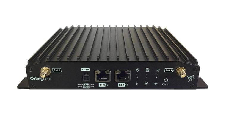
 Years ago there was a revolution in overseas travel; we no longer needed to learn the routes of a nation because satellites were able to tell us our position in real time (using GPS).
This technology was taken to another level by the professional market with the appearance of RTLS (Real Time Location Systems). These systems could use GPS signals, RFID (Radio Frequency Identification) or other mechanisms and made it possible to keep track of fleets, position emergency disaster services and control staff or critical resources all from a control center. The devices knew their location and could communicate this information.
Indoor positioning
But what happens inside, say, a convention center, a hospital or a logistics warehouse? In these environments the GPS signal does not work and while a spreadsheet can show the location of material resources and provide information on these, it remains an inefficient means of maintaining an inventory.
Indoor positioning systems or IPS (Indoor Positioning Solutions) quickly became necessary. Initially based on passive beacons they soon evolved into active elements emitting periodic radio signals and permitting a simple workstation, when you pass nearby, to deliver not just location information but also temperature readings, pressure, etc…
The mobility and social activity of human beings has been quickly linked to RTLS technology. Now it is possible for someone to have information on our location, how long we remain in one place or where we are headed, even without our knowledge, and this simple data becomes very interesting.
IPS and Wi-Fi network infrastructures
Most places today have wireless access for guests and we all have a smartphone with the Wi-Fi and/or Bluetooth functions usually turned on.
Wi-Fi enabled cell phones, tablets, etc., are constantly broadcasting 802.11 Probe Requests reporting on:
- The MAC source: that of the sending device.
- The SSID: the Wi-Fi network with which you want to connect.
- Data rates: supported by the device, channel in use, etc.
The majority of the time, these broadcasts occur without user intervention, continuing even once a connection to a wireless network has been established. This is because the mobility requires constant scanning of the network in order to roam between different access points and because it is always important to know which one provides the best connection quality.
Access points (APs) in the area around the user’s location obviously listen to the traffic that is sent and from then on it is simple to apply triangulation algorithms to estimate location. Now all that is needed is for this data to be sent to a management centre. Just imagine the range of reports and analyzes possible for a particular area where users are using Wi-Fi, for example:
- Routes taken by pedestrians and their status: congested, free, main direction, entrance, exit.
- Times: waiting, stopover, visiting, transit, speed.
- Areas of concentration: high density, uninhabited.
- Frequency of visits to each office, area or department.
- Security, emergency management and escape routes.
User interaction
All of the above information can be filtered by date, campaign, and zone, enabling not just real time analysis but also allowing the recipients of such information to make decisions based on user habits and even to propose changes or make suggestions. But how? Until now all the user did was to leave the wireless interface turned on.
Most people accessing places with free Wi-Fi will connect to the network and, if they so wish, can install a specific application of the place or facility in which they find themselves. Then a miracle occurs: the observer receives still more information while at the same time benefitting from other advantages that build customer loyalty, for example:
- Personal messages and offers tailored to the user purchasing profile.
- Self-scheduling for medical appointments and estimated waiting time.
- Auto guides for trade show rooms, business centers or museums.
- Automatic recognition of bank branch customers; a customer’s personal banking manager can go and greet the customer before he has even been announced.
It is now possible to see who will benefit from this technology:
- Hospitals, education centers, museums.
- Trade shows, convention centers, hotels and restaurants.
- Multi-branch corporations that provide personalized attention, malls.
All information obtained and analyzes basically consume a resource that is probably already available at the location: wireless network infrastructure. While initial location accuracy can be low, about 20-30 meters compared with 5-10 meters obtained with GPS, a preliminary study on how to position APs, a knowledge of the local area map and of the algorithms applied to these maps can provide much greater accuracy thus increasing the validity of the reports generated.
For greater accuracy, a low energy Bluetooth-based solution (BLE), the famous beacons, is available, but that is quite another story.
With regard to its clients, Teldat recognizes the potential of these technologies and views the development of these mobility solutions as an important aspect in supporting a sector that is poised for high growth in the market over the coming years.


